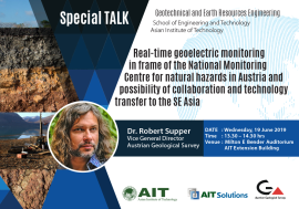
Special Talk on Real-time geoelectric monitoring in frame of the National Monitoring Centre for natural hazards in Austria and possibility of collaboration and technology transfer to the SE Asia by Dr. Robert Supper, Vice General Director of Austrian Geological Survey.
Date: Wednesday, 19 June 2019
Time: 13:30 – 14:30 hrs
Venue: Milton E Bender Auditorium, AIT Extension Building
ABSTRACT
The society of the 21st century faces great challenges. Protection of settlement areas and infrastructures from more frequent natural hazards resulting from climate change, the creation of sustainable raw material extraction, the protection of groundwater and exploitation of underground geothermal reservoirs provide the existentially important basis for the services for the public, the economic stability and growth of our country and the sustainable development of the society.
In order to develop adequate solutions to overcome these challenges, knowledge regarding the subsurface is of fundamental importance. The availability of this knowledge forms the basis for political decision-making processes (especially regarding spatial planning, resource exploitation and disaster protection) and is essential for the reduction of the risk of natural hazards and for the sustainable management of resources. However, to generate innovative knowledge, the availability of reliable, high quality data is a pre-condition. Nowadays, especially in the area of landslide monitoring, the geo-scientific community face a significant lack in multi-disciplinary, high quality, long term monitoring data sets. Specially to investigate triggering processes of landslides in more detail, a comprehensive set of monitoring data from landslides in different geological settings needs to be made available.
Almost 20 years ago the Geological Survey of Austria (GBA) began to build up a group of experts in the field of landslide monitoring. This ambition was pushed on in 1999, when the landslide event of Rindberg / Sibratsgfäll, clearly defined a demand for advanced, remote controlled monitoring systems of landslides, which hardly existed at that time. Consequently, GBA started the research on the development of multi-parametric monitoring systems for landslides. Due to the fact that heavy precipitation as well as related hydro(geo)logical flow dynamics are assumed to act as major triggering processes for gravitational mass movements in Austria, the geoelectrical method was introduced as a core methodology. From 2009 on, the GBA carried out several long-term monitoring experiments in Austria, Italy and France, testing the self-developed GEOMON4Dgeoelectrical system in different geological and geomorphological settings and is currently operating a multi-sensor monitoring network on European landslides.
This long lasting experience has strengthened GBA’s role as the national competence center for the acquisition and provision of high quality data and models of the subsurface. Currently the national center of Geo-monitoring is being established, based on a pioneering cooperation and clear division of roles between key player and stakeholder of the respective national and international geo-scientific research environment. Possibility of collaboration with Asian Institute of Technology and partners in the SE Asia will mentioned.

